Japan Earthquake | Page 1033
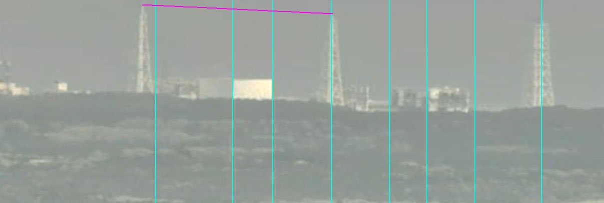
 @fitter the towers or the building high points?by Nancy 5/7/2011 8:15:50 PM
 @UKVal agree, thats why i wanted nancy to see if the stack at three was doing anything.... those buildings look so rough... don;t know how much more they can take of the shaking.. and the steam we saw today may inof itself have some minor effect... steam is very violentby fitter 5/7/2011 8:16:38 PM
 Typhoon No1 spawns off Philippines
The Japanese Meteorological Agency has announced that this year's first typhoon has appeared in waters east of the Philippines.
The agency announced that it developed from a tropical low pressure at 3 PM on Saturday.
The tropical storm has an atmospheric pressure of 998 hectopascals, with winds of up to 65 kilometers per hour near its center. The maximum wind speed is 90 kilometers per hour.
It is moving west-north-west at a speed of 20 kilometers per hour.
Saturday, May 07, 2011 22:57 +0900 (JST)by marie rich 5/7/2011 8:16:42 PM- @marie rich I think that is the one I saw posted recently, didn't realize it was the 1st. When was the last quake in the area? Was the one on the 1st the last one?by Nancy 5/7/2011 8:16:57 PM
- @Nancy towers use top center points.. of pipeby fitter 5/7/2011 8:17:04 PM
- @fitter ah, got it.by Nancy 5/7/2011 8:17:24 PM
 last quake was 2 hrs agoby UKVal 5/7/2011 8:19:27 PM
- may 3 (4) on land. told that’s unusual
earthquake.usgs.gov Magnitude 4.5 - NEAR THE EAST COAST OF HONSHU, JAPAN
2011 May 03 13:57:19 UTC
QuakeAlert
DATE : 05/05/2011 16:58:21
TIME : 17 minutes ago
REG. : off the east coast of Honshu, Japan
MAG. : 6.1
DEP. : 24.2 km
ID : 109078
quakes.globalincidentmap.com Magnitude mb 6.3
Region OFF EAST COAST OF HONSHU, JAPAN
Date time 2011-05-05 14:58:17.0 UTC
Location 38.30 N ; 144.04 E
Depth 2 km
Distances 240 km E Ishinomaki (pop 117,233 ; local time 23:58:17.8 2011-05-05)
215 km SE Kamaishi (pop 43,107 ; local time 23:58:17.8 2011-05-05)
Those are one's I found of interest- prob. been many more. 1600+ since 11Mar.by marie rich 5/7/2011 8:19:40 PM 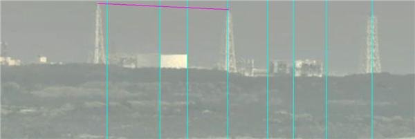
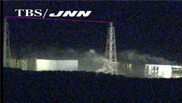
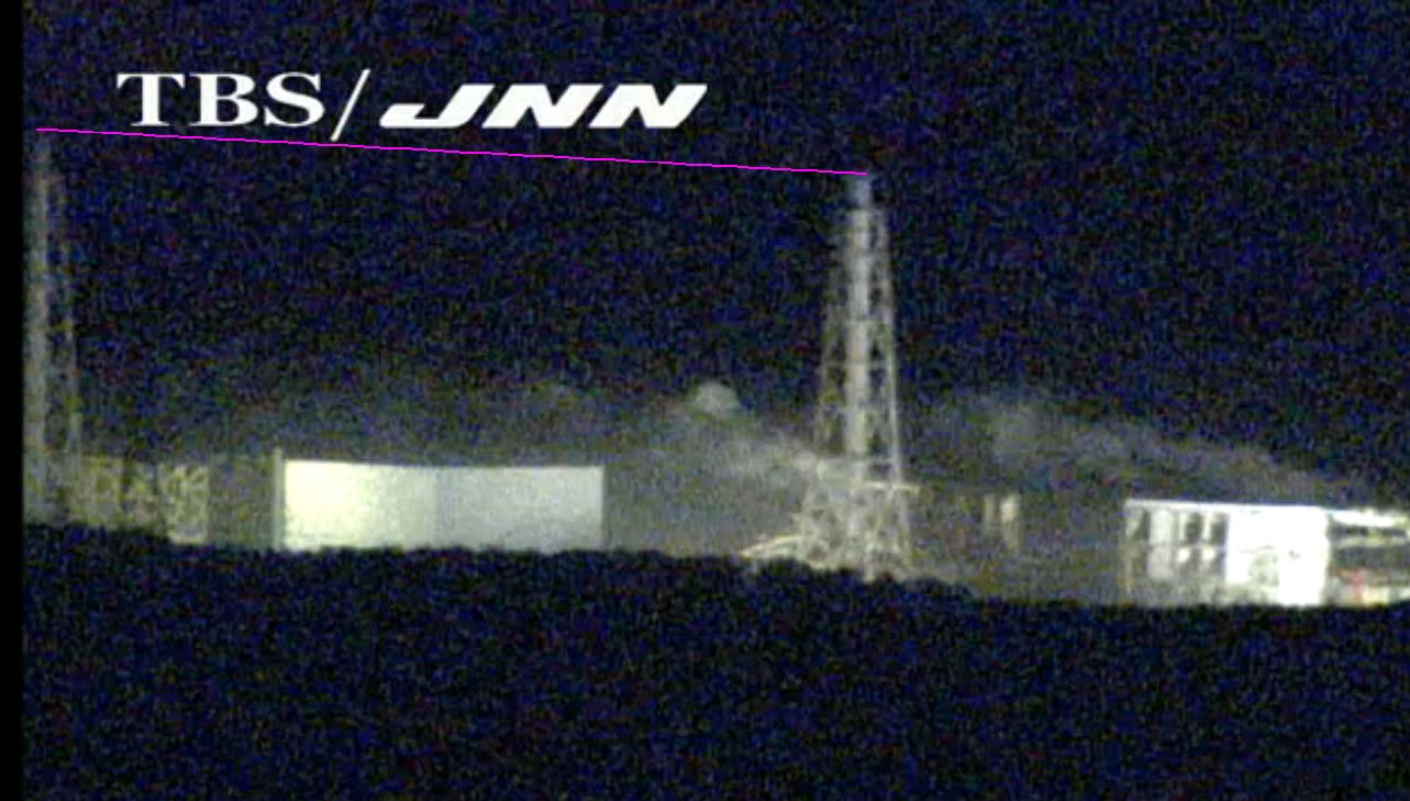
angle comparisons. Looks like towers have same height difference? www.houseoffoust.com .jpg
by Nancy via Houseoffoust 5/7/2011 8:22:02 PM- by Nancy 5/7/2011 8:22:23 PM
- by Nancy via Houseoffoust 5/7/2011 8:22:41 PM
 Looks like the whole place is on fire.by Jim 5/7/2011 8:23:26 PM
 @all - re. the lean of #4 the Grand Chancellor Hotel in Christchurch, NZ suffered foundation failure (possible due to liquifaction) in the Feb 22 2011 earthquake and developed an alarming and clearly visible lean en.wikipedia.orgby hudebnik 5/7/2011 8:23:41 PM
- View WunderPhotos® in: Tokyo, Japan
Weather at a Glance
Weather Station
Tokyo (RJTT)
Elevation
26 ft
Station Select
Now
Partly Cloudy
Partly Cloudy
Temperature
61 °F
Feels Like 61 °F
Wind(mph)
7
Sunrise / Set
4:42 AM
6:32 PM
Moon
Waxing Crescent
More Astronomy
Today
Chance of Rain 75 °F
Chance of Rain
30% chance of precipitation
Tonight
Partly Cloudy 59 °F
Partly Cloudy
0% chance of precipitation
Tomorrow
Mostly Cloudy 70by Jim 5/7/2011 8:25:49 PM - Does anyone know the scientific details of liquifaction? With all the excess water pouring into the ground and pretty much constant shaking I have to wonder if they are factors in 4 sinking and falling overby Nancy 5/7/2011 8:26:12 PM
- @nancy can you square the line so it runs at a horizontial elwvation, bring down the left side so it level but use the left start point as the center line of the pipe in the stack, or is the pic frame at an angleby fitter 5/7/2011 8:27:08 PM
- @Nancy The sediment grains become supported by water instead of contact which each other.by Jim 5/7/2011 8:27:16 PM
 it has been said the basement lies on bedrock. so no liquification if this is true.by Edano 5/7/2011 8:27:43 PM
- Hydralically supported is a term often used.by Jim 5/7/2011 8:28:18 PM
- @Edano agreed. not likely. but fractures...by marie rich 5/7/2011 8:28:45 PM
- i vote for structural failure.by Edano 5/7/2011 8:28:47 PM
- @Edano everything we have found says fuku is not on bedrock. Do you have a link for whatever is claiming it is?by Nancy 5/7/2011 8:29:20 PM
- @Edano I would second that.by Jim 5/7/2011 8:29:21 PM
- we could measure the #4 angles and calculate when it's over.by Edano 5/7/2011 8:30:29 PM
- @Edano deffenetly has some strucual failures...
what is the underground depth... do you knowby fitter 5/7/2011 8:30:44 PM - Just the lose of support would be enough. Clay minerals are usually the cause of liquifaction.by Jim 5/7/2011 8:30:44 PM
- geology.com/news/2011/liquefaction-and-soil-collapse-fr...by marie rich 5/7/2011 8:31:21 PM
 @Nancy On 3/11 Japan "jumped" 13 feet to the east, that can change things.by JMV 5/7/2011 8:32:02 PM
- try again... geology.comby marie rich 5/7/2011 8:32:07 PM
- You don't have to have bedrock to have a solid foundation, sand is a good footer.by Jim 5/7/2011 8:32:35 PM
- @JMV i believe it also sank some didn't itby fitter 5/7/2011 8:32:46 PM
- btw, the putzmeister is gone, isn't it ? i mean, not that it could be of any use elsewhere....by Edano 5/7/2011 8:32:47 PM
- Sand is not safe from liquefaction in an EQby marie rich 5/7/2011 8:34:18 PM
- I think what we are looking at here is loss of material. Not just soil composition, they made sure when they built it that it was on solid ground.by Jim 5/7/2011 8:35:18 PM
- fyi the containment bulb has a sand filled transition at the bottom egde... anyone know what that means???by fitter 5/7/2011 8:35:54 PM
- @fitter According to what I've read parts of the coastline sank up to 2.5 meters.by JMV 5/7/2011 8:36:18 PM
- @JMV That's too vauge to be useful.by Jim 5/7/2011 8:37:55 PM
- Quick description of liquefaction. btw, post below from geology.com is specifically about it in Japan EQ. Liquefaction is the name given to the process that converts a solid soil mass into a liquid.
Liquefaction occurs in cohesionless soils (typically those with a higher content of larger grains such as sand sized clasts) which have water in the pore spaces, and are poorly drained.
When the seismic waves from the earthquake pass through the soil, the vibrations cause the individual grains in the soil to move around and re-adjust their positions. This ultimately results in a decrease in volume of the soil mass as the grains pack more tightly together (a reduction in porosity).
The pore water which was originally in those spaces becomes compressed. Water is relatively incompressible and as such it pushes back against the soil grains (more correctly this is described as an increase in pore water pressure). The pore pressure becomes so high, that the soil grains become almost buoyant causing a significant drop in the shear strength of the soil to a very low value.
When this occurs the soil loses it's ability to support loads (technically described as a loss of bearing capacity) which can cause subsidence of building foundations.
First answer by ID3522331322. Last edit by SBDW1. Contributor trust: 143 [recommend contributor]. Question popularity: 2 [recommend question].by marie rich 5/7/2011 8:38:02 PM - @nancy just a thiught don't know how the pic programs work... can you project a line out from the top point of the stack... them measure down to the first roof line
corner and then down to the top roof line of the last cornerby fitter 5/7/2011 8:38:10 PM - @Edano: I also can't see it anymore. Or is it an optical thing because of the light?by Mina 5/7/2011 8:38:26 PM
- if they removed the putzmeister, they are surely awaiting a breakdown.by Edano 5/7/2011 8:39:24 PM
 The government's nuclear emergency response headquarters seven days, and establishes the standard to allow fishing in the waters off Fukushima Daiichi nuclear power plant over 30 km. Test results from water and radioactive materials, exposure of fishermen (nuked) or less was considered to limit the amount. The first set of marine safety standards.
www.asahi.comby elainekirk 5/7/2011 8:39:27 PM- @marie Actually fluid is more precise than liquid, not the same thing.by Jim 5/7/2011 8:41:01 PM
- @Edano not sure were disscusing this moring, it looks moved further up the buildingby fitter 5/7/2011 8:41:34 PM
- come on, when you plan a building of that size and weight you make sure that the fundament reaches bedrock. you will dig until you reach it. it's not pavement. it's a nuclear reactor. they won't build it in the dunes.by Edano 5/7/2011 8:42:31 PM
Japan Earthquake | Page 1033
- Who's Blogging
-
 hudebnik
 alblee
 UKVal
UKVal Jonathan Keebler
 Oliver (ScribbleLive)
 kaykodh
 Markfm
 Angie
Angie Mid Valley
 Matt (ScribbleLive)
 George Gibb
- elainekirk
 PKelley
 lillymunster
 dean
dean bo
bo Edano
Edano Deb
Deb- Pedro Jesus
 IanGoddard